In the evolving world of construction, infrastructure, and land development, precision is everything. Surveying is the foundation of all successful projects. Traditionally, land and building surveys were conducted using manual tools and optical instruments. But today, technology has transformed the landscape with the advent of 3D Laser Scanning Services in the UAE.
So, how does traditional surveying compare with 3D laser scanning, and why does it matter for professionals working with leading survey companies? Let’s dive into a detailed comparative analysis.
What is Traditional Surveying?
Traditional surveying involves manual data collection using instruments such as total stations, theodolites, and GPS units. Surveyors physically measure distances, angles, and elevations to map out land features or construction layouts. Common Traditional Surveying Techniques Include:- Total Station Surveys
- Theodolite Measurements
- GPS-Based Surveys
- Tachymetry and Leveling
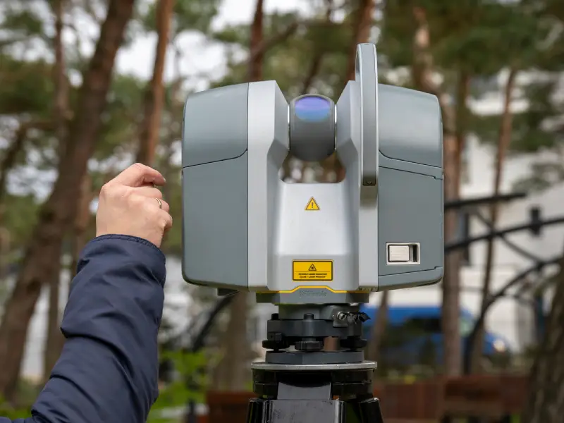
What is 3D Laser Scanning?
3D laser scanning is a modern surveying method that uses laser beams to rapidly capture millions of data points called a point cloud, that represent physical spaces and objects in three dimensions.
This method is increasingly popular for high-accuracy, time-sensitive, and complex projects in the UAE, particularly among top-tier survey companies in Abu Dhabi like Accurate Survey.
Traditional Surveying vs. 3D Laser Scanning: Key Comparisons
|
Feature |
Traditional Surveying |
3D Laser Scanning |
|
Accuracy |
High (within limits) |
Ultra-high precision (millimeter-level) |
|
Speed |
Time-Consuming |
Rapid Data Collection |
|
Data Output |
2D plans and measurements |
3D models, point clouds, BIM-ready files |
|
Accessibility |
Challenging for complex structures |
Easily captures inaccessible or intricate areas |
|
Manpower |
More manpower and time required |
Less manpower, faster completion |
|
Cost |
Lower upfront costs |
Higher initial investment, long-term savings |
|
Application |
Boundary, construction layout |
Industrial, heritage, architecture, clash detection |
Benefits of 3D Laser Scanning in Modern Projects
Enhanced Accuracy: Captures precise, high-resolution data, ideal for detailed architectural or structural analysis. Time Efficiency: Large areas can be scanned in hours, reducing project downtime. Risk Reduction: Minimizes manual work and human error, especially in hazardous or hard-to-reach areas. Detailed Documentation: Creates 3D digital twins for analysis, renovation, restoration, or asset management. Improved Collaboration: Enables BIM integration and cloud-based data sharing across teams and disciplines.When to Choose Traditional Surveying?
Traditional methods still have their place in:- Basic boundary or land surveys
- Cost-sensitive projects
- Areas with limited access to scanning tech
- Rural or undeveloped locations
Why Choose Accurate Survey for 3D Laser Scanning Services in UAE?
As one of the most trusted survey companies in Abu Dhabi, UAE Accurate Survey bridges traditional expertise with modern technology. Our 3D laser scanning services in the UAE are trusted by architects, engineers, facility managers, and government bodies for delivering unmatched detail and efficiency. Our 3D Laser Scanning Services Include:- High-definition point cloud capture
- Scan-to-BIM and 3D modeling
- Industrial plant and facility scanning
- Heritage and façade documentation
- Clash detection for MEP and renovation projects