When it comes to construction, development, or property acquisition, one thing is clear accurate land surveying is essential. From defining property boundaries to guiding structural planning, land surveys play a foundational role in ensuring success. In a dynamic and fast-developing city like Dubai, where land value is high and regulations are strict, choosing the right type of land survey is more important than ever.
In this blog, we explore the various types of land surveys and help you understand how to choose the one that best suits your project. Whether you’re building a residential villa, a commercial complex, or planning large-scale infrastructure, partnering with professional land survey companies in Dubai ensures you get the precision and compliance you need.
What is a Land Survey?
A land survey is the process of measuring and charting the physical features, boundaries, and elevations of a plot of land. Professional land surveyors use tools like GPS, drones, total stations, and 3D scanners to collect data. This information is then used to create accurate maps or models that assist in planning, legal documentation, and construction.Different Types of Land Surveys
Each project has its unique requirements. Here are the most common types of land surveys used across Dubai’s construction and real estate industries:1. Boundary Survey
Purpose: Defines legal property lines and ownership boundaries. Why It’s Needed: To avoid property disputes, ensure compliance with local regulations, and support property transactions. Land survey companies in Dubai often provide this service before property sales or developments.2. Topographic Survey
Purpose: Maps a plot’s surface features, including both natural and manmade buildings Why It’s Needed: Useful during the design and planning phase. Architects and engineers rely on topographic surveys to understand terrain elevation, drainage patterns, and site limitations.3. Construction Layout (Setting Out) Survey
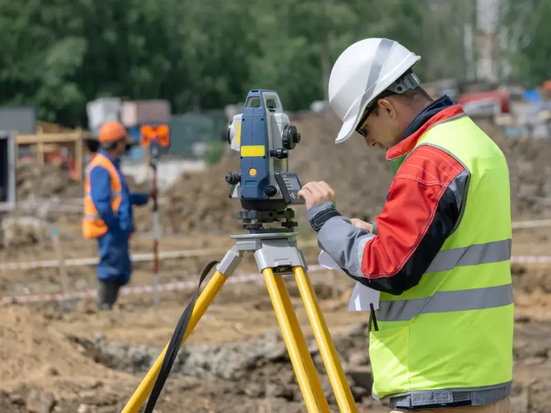
Purpose: Guides the actual construction by marking key positions of buildings, roads, and utilities on-site. Why It’s Needed: To ensure that the project is built exactly as planned, aligned with approved designs and engineering specifications.4. As-Built Survey
Purpose: Captures the project’s final built condition. Why It’s Needed: To verify whether construction aligns with the original design and for future maintenance, upgrades, or legal documentation.5. Subdivision Survey
Purpose: Divides land into plots or lots, often for residential or commercial development. Why It’s Needed: For legal registration of new plots and to meet municipal planning requirements.6. ALTA/ACSM Survey
Purpose:A complete land survey that includes boundaries, easements, and improvements. Why It’s Needed: Usually required by lenders, title companies, or investors for commercial real estate transactions in Dubai.7. Route Survey
Purpose: Designed for infrastructure projects like roads, pipelines, or utilities. Why It’s Needed: To chart the best path for linear infrastructure while minimizing environmental and legal issues.8. Hydrographic Survey
Purpose: Measures and maps underwater features and depths. Why It’s Needed: Hydrographic Survey is essential for marine construction projects, ports, harbors, and any development involving water bodies near Dubai’s coastal regions. It ensures accurate data for safe and efficient underwater infrastructure planning.How to Select the Right Type of Land Survey
Choosing the right land survey is based on several factors:- Project Type (residential, commercial, infrastructure)
- Regulatory Requirements (Dubai Municipality approvals)
- Terrain Complexity (flat desert vs. coastal or urban plots)
- Construction Stage (planning, execution, or post-construction)
- Purpose (legal, design, or verification)
Why Work with Professional Land Survey Companies in Dubai?
Dubai’s real estate and construction sectors operate under strict regulatory frameworks. Working with an experienced and licensed land survey company in Dubai offers major advantages:- Local Knowledge: Familiarity with Dubai Municipality requirements and landregulations.
- Advanced Technology: Use of drones, GPS, LiDAR, and 3D scanning for highly accurate results.
- Regulatory Compliance: Ensures your surveys meet legal and construction standards.
- Time & Cost Efficiency: Accurate surveys reduce rework, delays, and disputes.
Looking for Trusted Land Survey Companies in Dubai?
Choosing the right survey partner is key to your project’s success. With Accurate Survey, you gain access to certified professionals who bring deep knowledge of Dubai’s land regulations, terrain, and construction standards. Whether it’s a boundary survey for your private property, a topographic survey for commercial development, or a detailed layout survey for large-scale infrastructure, Accurate Survey delivers precise results you can trust. Every land survey has a specific purpose and selecting the right one helps you avoid costly delays, legal setbacks, and construction errors. With Accurate Survey by your side, you ensure every measurement is accurate and every decision is well-informed.Need expert guidance for your next project?
Contact Accurate Survey, your trusted partner among land survey companies in Dubai, and get started with confidence today!