A surveying control point is a mark or monument that has an established horizontal and vertical position by way of being surveyed and is identifiable on the ground.
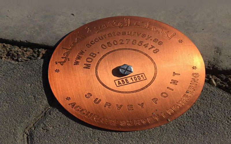
Permanent control points form the backbone of long-term surveying projects, providing ongoing accuracy for construction, infrastructure, or land development projects. We establish permanent control points that are robust and designed to maintain their integrity over time. These control points are carefully placed in accordance with national and international surveying standards, ensuring consistent reliability throughout the project lifecycle.
Establishment of Permanent Control Points:
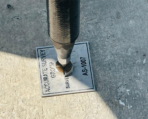
Temporary control points are essential for projects that require short-term accuracy in surveying. We establish these points with high precision, ensuring that they serve as reliable reference locations during the project’s timeline. Our experienced team ensures that these control points are carefully positioned to provide optimal coverage for your survey area.
Establishment of Temporary Control Points:
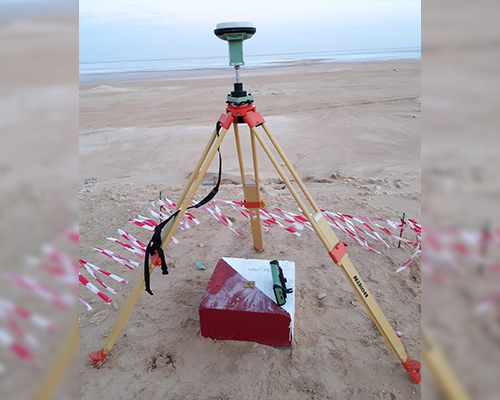
GNSS Static Survey
If you are establishing new survey control for a remote project and there isn’t any existing control on or near site, then a GNSS Classic Static Survey may be the preferred method.
GNSS classic static surveys involve setting up GNSS receivers on known and unknown geodetic survey marks and simultaneously observing the baseline between the points.
This method is ideal when transferring control over long distances to remote projects where there isn’t any existing, or sufficient control. Classic static surveys are acceptable for baselines less than 10kms.
GNSS RTK Survey
If the project you are working on doesn’t require a high level of accuracy, then you could be justified in using the GNSS RTK survey method.
This method is when you have your GNSS base station set up over a single known point, and it sends out corrections in real-time to the rover GNSS receiver when surveying new points.